Coastal Douglas-fir Forests: Present, past, and future
An overview of the historic extent and composition of CDF forests and associated habitats.
This article provides an overview of the historic extent and composition of CDF forests and associated habitats. It also explores how these places are anticipated to be affected by climate change and how conservation action and stronger environmental protection policy can ensure more climate stability and ecological resilience in an uncertain future.
It is well known among foresters and ecologists in British Columbia that the Coastal Douglas-fir (CDF) biogeoclimatic zone is among the most threatened assemblages of habitats in the province. Located in the rainshadow of Vancouver Island and the Olympic mountains, the CDF is a highly desirable region for settlement due to its historically warm dry summers and mild wet winters. It occupies only 0.3% of BC’s total area and occurs nowhere else in Canada (Centre for Forest Conservation Genetics, n.d.; MacKinnon, 2003). Though CDF associated ecosystems extend beyond BC’s borders into the United States, its extent there is also limited and vulnerable to the same pressures of Canada’s range with up to 526 species classified as imperiled, declining, or endemic to the ecoregion (MacKinnon, 2003; Floberg et al., 2004, p.139).
Present
Despite being among the most richly biodiverse of BC’s 16 biogeoclimatic zones, significant human pressure and lack of protection has resulted in severe ecological degradation (Shackleford et al., 2017). According to Dr. Tara Martin, not only is the CDF zone among the most threatened ecological regions in the province, Garry oak meadows, an ecological community found only within the CDF, are one of the most threatened in all of Canada (Garry oak Ecosystem Recovery Team, n.d.; Raincoast, 2021b).
Further, according to old-growth forest experts Dr. Karen Price and Dave Daust, only 37-40% of the CDF’s historic forested extent actually remains forested and estimate that about 17 km2 of these remaining forests are defined as old growth (Raincoast, 2021a). This is less than 1% of the amount of old growth that should be present in this region. Similarly, the province’s last State of the Forests report, released in 2010, found that the CDF is BC’s most converted zone, with nearly twice the amount of deforested and fragmented land compared to the next most converted zone. This includes the highest road density of any biogeoclimatic zone, which profoundly fragments habitats.
In 2008, BC’s Biodiversity Atlas ranked the CDF as “imperilled”, meaning it is “At high risk of extinction due to very restricted range [and] steep declines [of species and habitat]” (Austin et al., p.31). It is thus unsurprising that the CDF is also one of three zones with the highest number of threatened and endangered forest-associated species (Ecora, 2020). Data from BC’s Conservation Data Centre shows that within the CDF’s range there are 44 ecological communities at risk, along with 94 vertebrate animal, 65 vascular plant, 45 invertebrate animal, 5 lichen, and 3 bryophyte species (BC CDC, 2021) as is shown in Figure one. Overall, ecological integrity is teetering on a tipping point throughout the CDF zone, or in the words of Dr. Price, “everything is at risk” (Raincoast, 2021a).

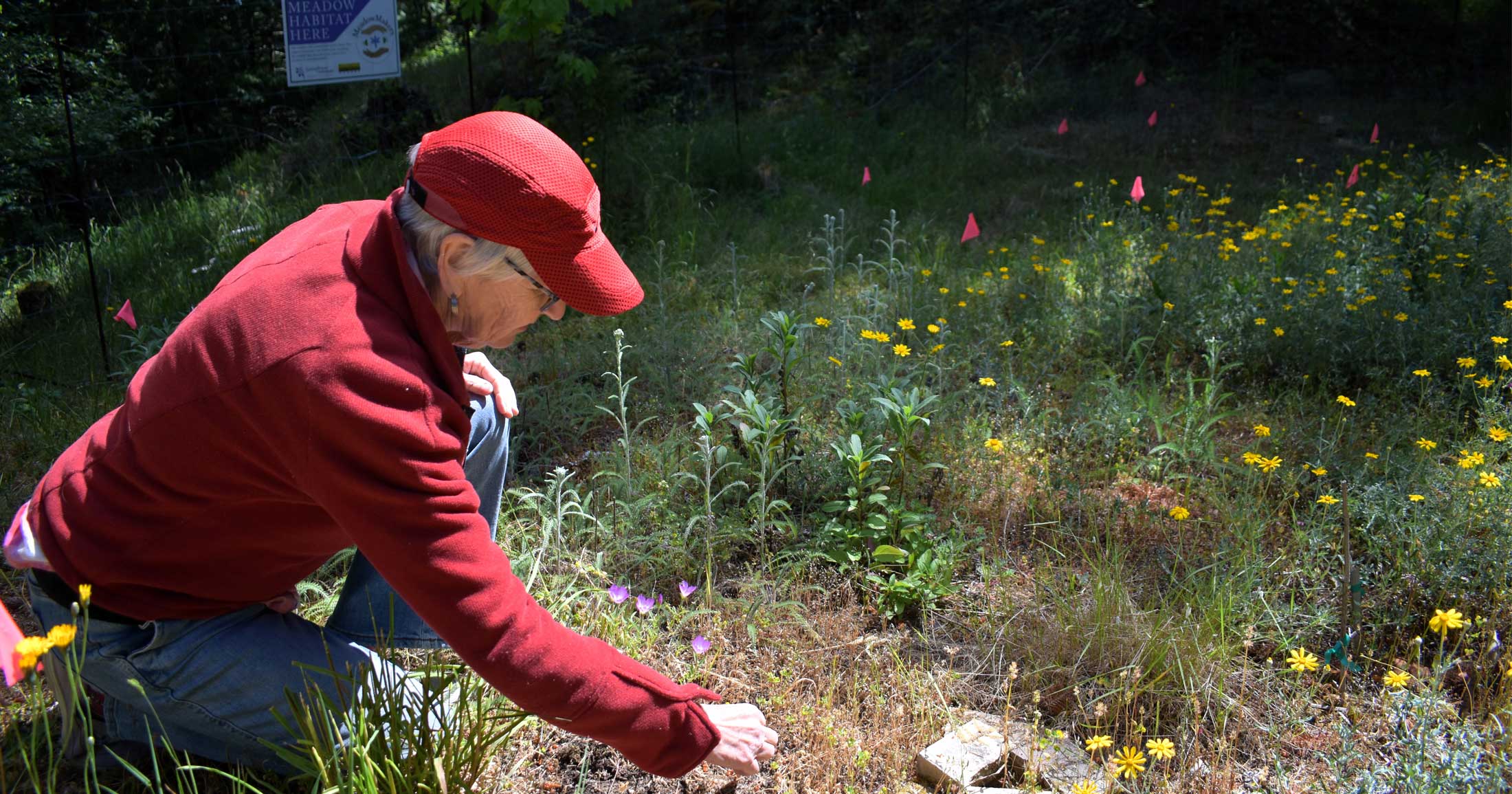
Though the legacy of logging, conversion to agriculture, and residential development has significantly altered the CDF forests within this zone, there are still tracts of intact habitat that remain. Protecting these places is increasingly important as the effects of climate change intensify. This article provides an overview of the historic understanding of CDF forests and associated ecosystems and explores the uncertainty surrounding the shifting baselines of climate change. It also calls on policymakers to implement stronger forest protection policy, not only in the CDF but across BC.

Past
There are eight forest regions that stretch across Canada (Rowe, 1972). Most provinces are representative of one to three of these distinct regions. British Columbia however, boasts five, making its forests the most diverse in the country. In 1992, renowned BC Forest Service ecologist Andy MacKinnon and colleagues described the unique climatic and topographical mosaic of BC as being at once dazzling, daunting, and bewildering (MacKinnon, Meidinger, & Klinka, 1992).
To understand this robust ecological complexity and biodiversity two widely used hierarchical ecological classification systems were developed beginning in the late-1940s. These systems continue to provide insight into the structure and function of infinitely complex and interconnected ecosystems at a scale that is comprehensible and applicable on the ground. The Ecoregion Classification (EC) system, “describes broad regional ecosystems based on the interaction of climate and physiography” (BC Forest Service Branch, n.d.) and can provide insight into habitat diversity across the province (Demarchi, 1996). However, the complementary Biogeoclimatic Classification or “BEC” system, which “delineates ecological zones (biogeoclimatic units) by vegetation, soils, and climate”, is generally more widely used as it provides a much finer level of detail and insight into the historic species composition in the CDF zone.

Inherent to understanding biogeoclimatic zones is that each is an assemblage of ecological communities and habitat types. This means that though there are individual plant species characteristic of each zone, individual species are not definitive of the zone as a whole. For example, coastal Douglas-fir, which is distinct from its interior cousin (see Figure 2), is the most common tree species found within the CDF zone. However, it is only one species within a larger collection, which also includes arbutus (the only broadleaf evergreen tree in BC); western redcedar; grand fir; and red alder among others (Nuszdorfer, Klinka, & Demarchi, 1991). Garry oak meadows are an example of an entire ecosystem type classified within the CDF zone, which not only contain Garry oak trees, but many additional species, like white-topped aster, camas, and deltoid balsamroot (Nuszdorfer, et al., 1991). In addition to meadows, Garry oak ecosystems also include shady woodlands and scattered trees (Garry oak Ecosystem Recovery Team, 2021). Taken together these examples demonstrate the deep diversity and complexity of the CDF zone, which cannot be reduced to a single species or ecosystem type.

There are at least 50 rare plant species restricted to the CDF zone, many of which are at the northern limit of their distribution (Nuszdorfer et al., 1991). Though wetland ecosystems are now rare within the region due to agricultural development, peatland and mineral wetlands were once common (MacKenzie & Moran, 2004). Further, the CDF and surrounding coastal area provides vital habitat to 90% of all known bird species in BC and the only breeding population of Double-crested Cormorants and most colonies of Glaucous-winged Gulls occur on the Gulf Islands, within the CDF’s range (Demarchi, 1996). Overall, the assemblage of habitats from BC to Oregon is incredibly diverse, with 217 distinct nearshore, terrestrial, and freshwater ecological systems identified (Floberg et al., 2004).
This diversity has long been fostered by local Coast Salish Nations through practices like low-intensity burns that have since been largely eliminated by land alienation, development, and Eurocentric resource philosophy. For example, Garry oak meadows were food producing ecosystems managed using low-intensity fire to encourage the growth of dietary staples like camas and chocolate lily. Though these ecosystems remain on the landscape, their occurrence has been dramatically reduced and those that remain are severely fragmented and much less productive than they were historically (Raincoast, 2021b). Further, though food and materials were harvested from forested ecosystems, they were taken using sustainable approaches. Bark was often stripped from western redcedars for materials and from coastal Douglas-fir for fire fuel, and the trees left standing. Many of these culturally modified trees (CMTs) are still alive today, a living testament to the stewardship-basis of ecosystem management that sustained multiple Nations for generations prior to non-Indigenous settlement in the region.
Assemblages of ecosystems, similar to BC’s CDF forests and associated habitats also occur on the American side of the border in coastal Washington and the Willamette Valley in Oregon (Franklin & Dyrness, 1973). While these regions have similarities,”the effect of the adjacent mountains, ocean intrusions, and glaciation in the region’s northern two-thirds have caused dramatic localized differences in climate, soils, and geology” (Floberg et al., 2004, p.15). Further, varied management regimes, industry growth, and human settlement observed on both sides of the border have radically changed ecosystem composition and structure. As of 2004 over 40% of the entire range from BC to Oregon had been converted to “urban or tilled agricultural use, [with] most of the remainder [in] production forestry, making this the most highly developed of the Pacific Northwest ecoregions” (Floberg et al., 2004, p. 15). It is reasonable to expect that this proportion of converted land has only increased in the past two decades.
Future
CDF forests throughout their southwestern BC range are known to exhibit a range of adaptive genetic variation that is poorly understood. What is clear, though, is that trees are strongly adapted to their local environments and tolerances to cold and drought differ across the Pacific Northwest (Bansal et al., 2015; Vangestel et al. 2018). Since locally adapted forest species differ in their adaptive plasticity to climate change and extreme weather conditions, their response and resilience to future weather extremes and climate change will also differ from other forests across this geographic range. In other words, stands of Douglas-fir in one area within the CDF will not respond to future climate conditions in the same way as stands in another area (Bansal et al., 2015). More broadly, though trees are generally understood to have high plasticity there are limits to the adaptive capacity of trees with drought being an especially limiting factor (Isaac-Renton et al., 2018).
In the words of Dr. Ruth Waldick of Transition Salt Spring: “climate change impacts aren’t about averages, they are about extremes” (Raincoast, 2021a). This means longer, more frequent, and increasingly severe weather like droughts and rainfall events than those already experienced in the last decade. While there is scientific consensus that these changes are expected to worsen, their severity and frequency are difficult to project, and according to Dr. Richard Hebda, the rate at which they are already occurring is unprecedented (Transition Salt Spring, 2021).
Despite these uncertainties, current climate projections suggest that the relatively stable climate envelope that has encompassed the CDF region over the last several 1,000 years is already shifting. By 2100 the historic climate of the CDF region is expected to more closely resemble that of the forests of northern Washington (characterized by the dry Coastal Western Hemlock biogeoclimatic zone) and the redwood forests of northern California (Raincoast, 2021a). This does not mean that entire ecosystems will move. Instead, some species that currently characterize the CDF zone will struggle to adapt and thrive under new climatic conditions. For example, some species such as the coastal Douglas-fir are expected to persist in this region and may even hybridize with similar species to adapt to changing conditions (Aitken et al., 2008). Other species, like western redcedar are not expected to fare as well, with most models predicting they will be unsuitable to this region within this century (Raincoast, 2021a). Generally, most studies–with very few exceptions–show that native forests will struggle to adapt to changing climates and will ultimately become less productive in future climate scenarios (O’Neill, Hamann, & Wang, 2008; Isaac-Renton et al., 2018).
While scientists have been exploring assisted migration strategies (i.e. planting species already adapted to expected climatic conditions) to account for these shifting baselines over many decades, it remains unclear how introducing non-native species into local habitats will affect existing relationships between species and projection models are still subject to bias and uncertainty (Aitken et al., 2008; Krcmar et al., 2016; Boiffin, Badeau & Bréda, 2017). Further, according to the province: “Managing forests for biodiversity means maintaining the native diversity of genes, species, populations, habitats, and ecosystems” (BC Ministry of Forests, n.d., emphasis added).
Ultimately, it will be local conditions and degree of disturbance that will determine how well CDF forests do in the future. As canopy cover is lost, remaining forests are subject to higher local surface temperature and the loss of soil moisture (Prevedello et al, 2019). The loss of forest canopy, in turn, affects the local soil ecology, impeding beneficial interactions between plants, microbes and mycorrhizae, increasing the vulnerability of the remaining forest area to disease and infection, among other factors (Walter, 2018). Weather extremes like those experienced across BC in 2021 will compound these effects. According to Dr. Richard Hebda, the best thing we can do in the face of so much uncertainty is protect the forests that are still standing (Transition Salt Spring, 2021).
Challenges to protection and what we can do
One of the biggest challenges of safeguarding CDF habitats into the future is the high proportion of private land ownership throughout the region, which amounts to roughly 80% of the land base (Floberg et al., 2004). About 95% of BC’s landbase is provincial and federal Crown land, making the CDF region an anomaly in the province (BC, n.d.). Accordingly, protected areas within this zone are generally small and disconnected. This patchwork of protection is at odds with one of the most vital strategies for maintaining ecological integrity and viable habitat within forest ecosystems: connectivity. As such, private land acquisition has become the most surefire way to secure long-term habitat protection in the CDF.
However, this model is unlikely to remain feasible considering the rising price of land not only in BC, but across Canada. Improved environmental protection policy needs to be implemented to ensure these habitats are maintained. Though environmental development permits and other regulatory tools are often used in BC, they are largely unenforceable, especially on private land (Curran, 2007). Further, the precarious state of CDF forests and associated habitats clearly reflect the ineffectiveness of BC’s piecemeal environmental protection to date.
Though all ecosystems are intrinsically valuable, intact forests provide a plethora of climate mitigation services that will become increasingly important in the decades to come. Structurally and biologically diverse forests have been shown to play a central role in stabilizing slopes and reducing washouts, supporting groundwater cycles and recharge (Guthrie et al., 2010; Araújo Santos, Correia, & Coelho, 2020). They also cool air temperatures at ground level and increase soil moisture which act together to reduce the severity of heat events at highly local scales. Additionally, BC’s coastal forests are incredible carbon sinks, with Gulf Islands CDF forests having exceptional carbon sequestration capacity (Schuster, 2014).
While the current state of CDF forests demands urgent action, an ecological region, community, or species, should not have to be teetering on the brink of collapse to inspire meaningful conservation action from policymakers. Forests across BC require better long-term management to maintain stability and resilience. We must avoid being distracted by perspectives that cling to past management paradigms and fail to acknowledge the rapidly emerging changes under current warming. Innovative nature-based solutions, alternative development regimes, and widespread ecological restoration are all needed to ensure these precious ecosystems are protected into the uncertain future we collectively face.
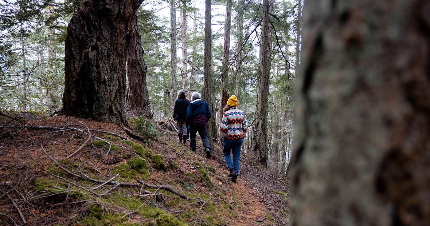
Raincoast’s Gulf Islands Forest Project combines
community engagement with science and policy review
to achieve tangible conservation outcomes.
Works cited
Aitken, S. N., Yeaman, S., Holliday, J. A., Wang, T., & Curtis-McLane, S. (2008). Adaptation, migration or extirpation: climate change outcomes for tree populations. Evolutionary Applications, 1 (1). 95-111. DOI: 10.1111/j.1752-4571.2007.00013.x
Austin, M.A., Buffett, D.A., Nicolson, D.J., Scudder, G.G.E., & Stevens,V. (eds.). (2008). Taking nature’s pulse: The status of biodiversity in British Columbia. Biodiversity BC. http://www.biodiversitybc.org/assets/pressReleases/BBC_StatusReport_Web_final.pdf
Araújo Santos, L.M., Correia, A.J.P.M. & Coelho, P.A.L.F. (2010). Post-wildfire slope stability effects and mitigation: a case study from hilly terrains with unmanaged forest. SN Applied Sciences 2, 1883. DOI: 10.1007/s42452-020-03660-8
Bansal, S., St. Clair, J.B., Harrington, C.A., Gould, P.J. (2015). Impact of climate change on cold hardiness of Douglas-fir (Pseudotsuga menziesii): environmental and genetic considerations. Global Change Biology, 1-13. DOI: 10.1111/gcb.12958
British Columbia Conservation Data Centre. (2021). BC Species and Ecosystems Explorer. British Columbia Ministry of Environment. Victoria, B.C. Available: https://a100.gov.bc.ca/pub/eswp/ (accessed Nov 19, 2021).
British Columbia Forest Services Branch. (n.d.). How BEC Works. Biogeoclimatic Ecosystem Classification Program. https://www.for.gov.bc.ca/hre/becweb/system/how/index.html.
British Columbia Ministry of Forests, Lands, and Mines. (2010). The state of British Columbia’s forests. Forest Practices and Investment Branch. https://www2.gov.bc.ca/assets/gov/environment/research-monitoring-and-reporting/reporting/envreportbc/archived-reports/sof_2010.pdf
British Columbia. (n.d.). Working on the land base. https://www2.gov.bc.ca/gov/content/industry/natural-resource-use
British Columbia Ministry of Forests. (n.d.). Biodiversity facts. https://www.for.gov.bc.ca/hfd/pubs/docs/bro/bro06.pdf
Centre for Forest Conservation Genetics. (n.d.). About BEC & BGC units. University of British Columbia. https://cfcg.forestry.ubc.ca/resources/cataloguing-in-situ-genetic-resources/cdf-zone/
Curran, D. (2007). Green bylaws toolkit for conserving sensitive ecosystems and green infrastructure. Environmental Law Centre & Ducks Unlimited Canada. https://www.toolkit.bc.ca/sites/default/files/GreenBylaws_toolkit.pdf
Demarchi, D. A. (1996). An introduction to the Ecoregions of British Columbia. Ministry of Environment Lands and Parks Wildlife Branch. http://www.llbc.leg.bc.ca/public/PubDocs/bcdocs/325282/techpub_rn324.pdf
Ecora Engineering and Resource Group Ltd. (2020). Environmental overview: Lot 1/2 SEC19 Gabriola Island. http://webfiles.islandstrust.bc.ca/islands/local-trust-areas/gabriola/current-applications/GB-RZ-2020.1%20(Gabriola%20Housing%20Society)/5.%20%20Other%20Information/2020-01_Environmental%20Assessment%20Report,%20by%20Ecora.pdf
Floberg, J., Goering, M., Wilhere, G., MacDonald, C., Chappell, C., Rumsey, C., Ferdana, Z., Holt, A., Skidmore, P., Horsman, T., Alverson, E., Tanner, C., Bryer, M., Lachetti, P., Harcombe, A., McDonald, B., Cook, T., Summers, M., Rolph, D. (2004). Willamette Valley-PugetTrough-Georgia Basin ecoregional assessment. The Nature Conservancy, the Nature Conservancy of Canada, Washington Department of Fish and Wildlife. https://ir.library.oregonstate.edu/concern/defaults/12579z018
Franklin, J.F. & Dyrness, C.T. (1973). Natural vegetation of Oregon and Washington. U.S. Forest Service and Department of Agriculture, Publ. No. PNW-8. Portland, Oregon. https://www.fs.fed.us/pnw/pubs/pnw_gtr008.pdf
Garry oaks Ecosystem Recovery Team. (n.d.). Protecting Garry oak areas during land development. https://goert.ca/wp/wp-content/uploads/GOERT-Protecting-During-Land-Development-2007.pdf
Garry oaks Ecosystem Recovery Team. (2021). What are Garry oak & associated ecosystems?. https://goert.ca/about/what-are-geo/.
Guthrie, R.H., Hockin, A., Colquhoun, L., Nagy, T., Evans, S.G., Ayles, C. (2010). An examination of controls on debris flow mobility: Evidence from coastal British Columbia. Geomorphology (114), 4, (601-613). DOI: 10.1016/j.geomorph.2009.09.021
Hosie, R.C. (1973). Native trees of Canada. Canadian Forestry Service Department of the Environment.
Isaac-Renton, M., Montwé, D., Hamann, A., Spiecker, H., Cherubini, P., & Treydte, K. (2018). Northern forest tree populations are physiologically maladapted to drought. Nature Communications, 9 (5254), 1-9. DOI: s41467-018-07701-0
Krcmar, E., Mah, S., Nigh, G., Fletcher, C., & van Kooten, G.C. (2015). Uncertainty in adaptation to climate change in forest management. FFESC project 2009-010. http://www.llbc.leg.bc.ca/public/pubdocs/bcdocs2017/668273/krcmarfinalreportsept12.pdf
MacKenzie, W.H. & Moran. J.R. (2004). Wetlands of British Columbia: a guide to identification. Resource Branch, BC Ministry of Forests. Victoria, B.C. Land Management Handbook No. 52. http://www.for.gov.bc.ca/hfd/pubs/Docs/Lmh/Lmh52.htm
MacKinnon, A., Meidinger, D., Klinka, K. (1992). Use of the biogeoclimatic ecosystem classification system in British Columbia. The Forestry Chronicle, 68 (1), 100-120. DOI: 10.5558/tfc68100-1
MacKinnon, A. (2003). West coast, temperate, old-growth forest. The Forestry Chronicle, 79 (3), 475-484. DOI: 10.5558/tfc79475-3
Nuszdorfer, F.C., Klinka, K., & Demarchi D.A. (1991). Chapter 5: Coastal Douglas-fir Zone in D. Meidinger & J. Pojar (Eds.), Ecosystems of British Columbia (pp. 81-95). BC Ministry of Forests. https://www.for.gov.bc.ca/hfd/pubs/docs/srs/srs06.pdf
O’Neill, G.A, Hamann, A., Wang, T. (2008). Accounting for population variation improves estimates of the impact of climate change on species’ growth and distribution. Journal of Applied Ecology, 45. 1040-1049. DOI: 10.1111/j.1365-2664.2008.01472.x
Prevedello, J.A., Winck, G.R., Weber, M.M., Nichols, E., & Sinervo, B. (2019). Impacts of forestation and deforestation on local temperature across the globe. Plos One, 14(3). DOI: 10.1371/journal.pone.0213368
Raincoast Conservation Foundation. (2021, November 17). Coastal Douglas-fir forest conservation: Ecoforestry & fire management. [Webinar]. https://youtu.be/EpmzkLlQHt8
Raincoast Conservation Foundation. (2021, November 24). Ecological carrying capacity of island ecosystems. [Webinar]. https://youtu.be/kayhhdbIiDo
Rowe, J.S. (1972). Forest regions of Canada. Department of the Environment, Canadian Forestry Service, Publ. No. 1300.
Schuster, R. (2014). Carbon and biodiversity mapping and assessment for the Islands Trust Area. http://www.islandstrustconservancy.ca/media/71757/carbonassessment.pdf
Shackleford, N., Standish, R.J. Ripple, W., Starzomski, B.M. (2017). Threats to biodiversity from cumulative human impacts in one of North America’s last wildlife frontiers. Conservation Biology, 32(3), 672-684. DOI: 10.1111/cobi.13036
Transition Salt Spring. (2021, June 30). What’s happening to our trees and forests?. [Webinar]. https://transitionsaltspring.com/whats-happening-to-our-forests-and-trees-video/
Walter, J. (2018). Effects of changes in soil moisture and precipitation patterns on plant-mediated biotic interactions in terrestrial ecosystems. Plant Ecology, 219, (1449–1462). DOI: 10.1007/s11258-018-0893-4