Community water monitoring
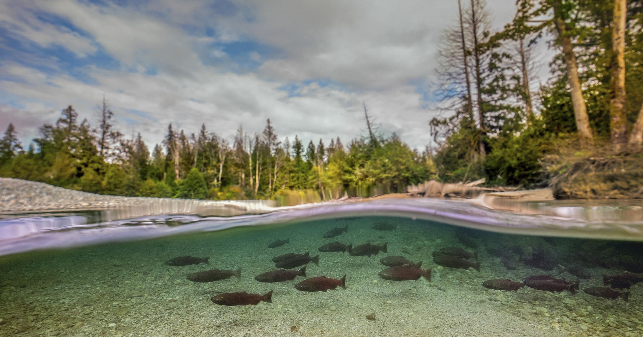
Clean water is essential for people, salmon, and whales. We are working with Indigenous Nations, communities, and governments as we operationalize a new approach to water pollution monitoring. Watersheds are serving as the basis for characterizing water quality from mountain peaks to the sea, providing an opportunity to identify pollution sources or activities that degrade fish habitat.
We have begun our work in select watersheds that drain into the Fraser River and Salish Sea. Our goal is to combine a high quality analysis of water in all partnering watersheds, with a mix of engagement and capacity-building activities that are unique to each area.

Working with partners
Our Healthy Waters community water pollution monitoring program works within several watersheds in BC. These include the Chemainus River, Cowichan River, and Tod Creek on Vancouver Island, and the Cheakamus River at Whistler, Sumas Lake watershed in the Fraser Valley, and Hope Slough near Chilliwack. We have conducted a first round of sampling in all of these watersheds during the ‘wet season’ in late 2023, after an initial ‘dry season’ sampling in the Whistler/Cheakamus corridor. We have also conducted focused pilot projects in the Sumas Lake area in the Lower Fraser Valley, and in Fulford Harbour on Salt Spring Island.
We continue to grow our program, and are expanding our partnerships with new Indigenous Nations and communities. Each watershed will benefit from expert support, transparent data sharing, training, and capacity-building. Findings from each watershed-based project will be integrated into a public-facing website featuring an in-depth summary of contaminant threats within and among watersheds.
Science to inform conservation
Findings from our water pollution monitoring will enable solution-oriented activities and practices that protect and restore fish habitats in BC. Our comprehensive, high-resolution analysis of water will document the extent to which hundreds of different contaminants that are released into BC waters, such as nutrients, metals, hydrocarbons, pesticides, pharmaceuticals, surfactants, PCBs, perfluoro-alkyl substances and tracers of human waste. This spectrum of analyses will support source identification and a ranking of risks to fish habitat within and among watersheds, supporting source controls and best practices in waste management, civil engineering and riparian zone design.
Mobile lab providing access to watersheds
We have acquired an all-wheel drive cargo van, and are now working on converting this into a fully functional mobile laboratory. This means designing, building, and deploying this vehicle – to be named Tracker as a community-oriented, mobile water pollution monitoring lab in support of healthy ecosystems in BC.
Watershed PARTNER reports
Anderson Creek watershed reports
- 2023/2024 wet season, DOI: 10.70766/126.498
- 2024 dry season, DOI: 10.70766/769.770
Chemainus River watershed reports
- 2023/2024 wet season, DOI: 10.70766/2681.52
- 2024 dry season, DOI: 10.70766/2051.77
Quw’utsun Sta’lo’ (Cowichan River) watershed reports
- 2023/2024 wet season, DOI: 10.70766/16804.3
- 2024 dry season, DOI: 10.70766/66.9084
False Creek watershed reports
Reports forthcoming.
Green/Cheakamus watershed reports
- 2023 dry season, DOI: 10.70766/955.423
- 2023/2024 wet season, DOI: 10.70766/9365.56
- 2024 dry season, DOI: 10.70766/4792.51
Harrison River watershed reports
Reports forthcoming.
Sqwa:la (Hope Slough) watershed reports
- 2023 wet season, DOI: 10.70766/81.8319
- 2024 dry season, DOI: 10.70766/16224.5
Tatalu (Little Campbell) River watershed reports
Reports forthcoming.
Louis Creek watershed reports
- 2024 dry season, DOI: 10.70766/86831.4
Nicola River watershed reports
- 2023/2024 wet season, DOI: 10.70766/3744.26
q̓ʷətəms t̓ɩšosəm (Sliammon River) watershed reports
- 2024 dry season, DOI: 10.70766/3261.54
Tod Creek watershed reports
- 2023/2024 wet season, DOI: 10.70766/76.9001
Accessory reports
Grafton Lake, Nexwlélexwm (Bowen Island)
Dry season, 2025, DOI: 10.70766/31.2601
W̱E¸NÁ¸NEĆ/Hwune’nuts (Fulford Harbour, Salt Spring Island, British Columbia)
Semá:th X̱ó:tsa (Sumas Lake) region

Our partners
- Cheam First Nation
- Chemainus First Nation
- Cowichan Tribes
- Tsartlip First Nation
- W̱SÁNEĆ Leadership Council
- Lower Fraser Fisheries Alliance
- Fisheries and Oceans Canada
- Environment and Climate Change Canada
- Metro Vancouver
- Capital Regional District of Victoria
- Pacific Salmon Foundation
- Ocean Diagnostics Inc.
Recent articles

The story of Coastal Douglas-fir forests: All about Mayne Island
Though smaller and more developed than some of its counterparts…

Junior researchers in the temperate rainforest
Investigating how forests and wildlife work together.

Worksheet: Junior researchers in the forest
Do you want to know more about forest ecosystems, but…

Mapping thermal refuges: Identifying critical cooling centres for salmon in the Coldwater River
The salmon populations in the Nicola watershed are among the…

After dark with the Southern Residents
Overnight hydrophone recordings capture killer whales navigating through a noisy…

Decoding killer whale communication is key to defending their home
An increasingly noisy ocean is threatening the survival of this…

Guide to public comments on proposed regulations to protect Southern Resident killer whales
Take action and support the 1,000m minimum approach distance.

Letter in support of the proposed increase of a 1,000m approach distance for Southern Resident killer whales
The Government of Canada is seeking public feedback on proposed…