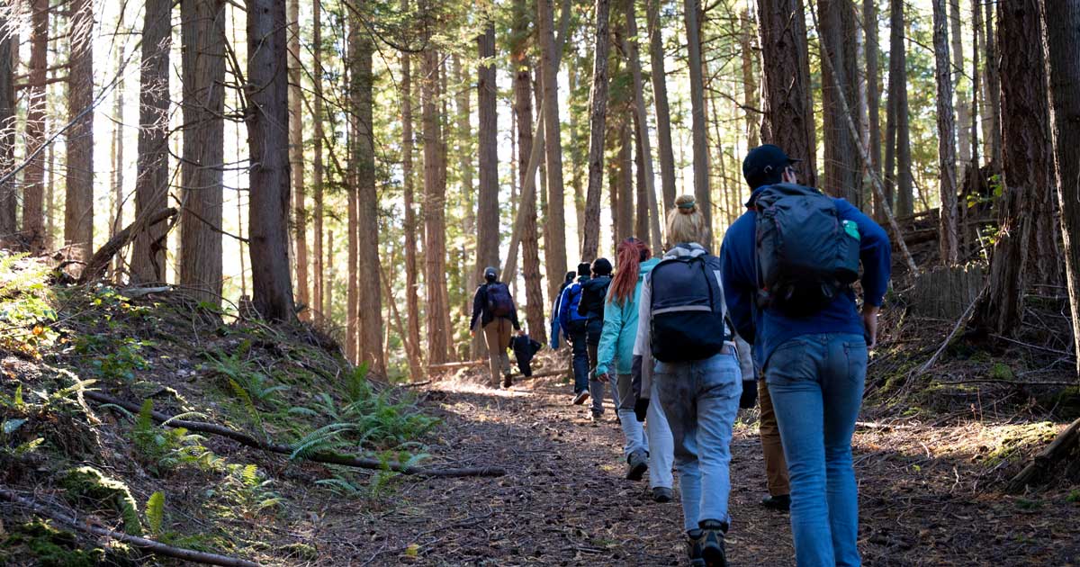
Protecting salmon habitat
Removing barriers in the fragmented Fraser River Estuary.
Photo by Fernando Tessa.
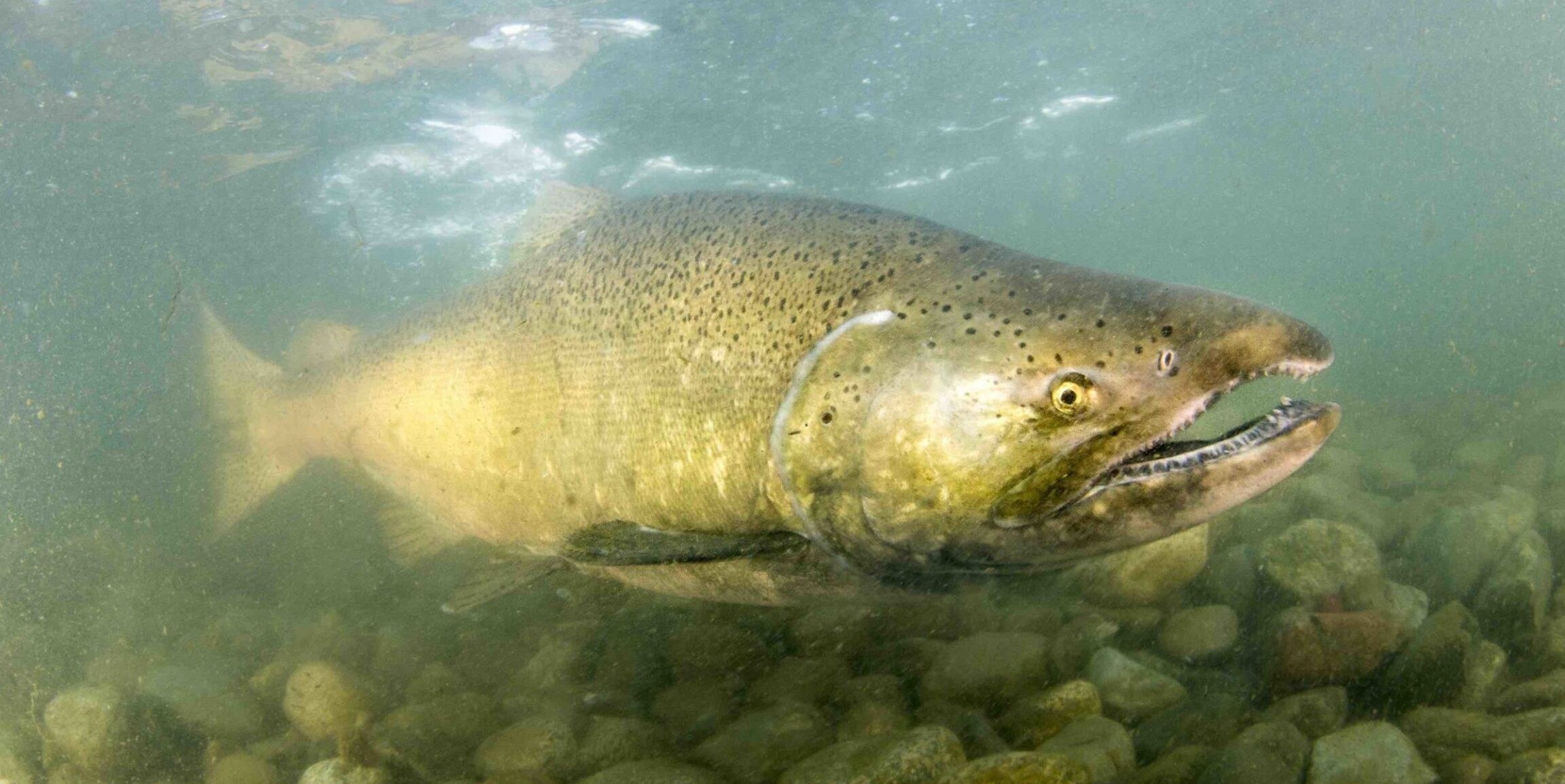
The Lower Fraser River and Estuary is a highly modified environment with more than 70% of tidal marsh habitats that juvenile salmon rely on lost or locked away behind man-made structures. On the Fraser Delta, this includes the jetties, causeways and training walls that were built to control the arms of the river for ship navigation.
These structures highly fragment the estuary. They alter the flow of water, sediment and nutrients. They also restrict the passage of juvenile salmon that want to move into the shallow tidal salt marshes and eelgrass to feed and grow. For juvenile Chinook, chum, and pink salmon, which enter the estuary as fry, the lack of access to marsh habitats may be particularly harmful, as they may not have had time to prepare their bodies for the transition to salt water.

Woods Island Marsh
The Woods Island Marsh is located in the North Arm of the Lower Fraser River. It is a habitat compensation marsh created to offset the impacts of building and operating a barge-offloading facility associated with the Vancouver International Airport (YVR). This project site was planted with native Lyngbye’s sedge, however, over the years the site has become completely dominated by hybrid cattail, an invasive species that reduces the quality of habitat for juvenile salmon.
Our five-year restoration project
In 2016, Raincoast began a five-year restoration project to create openings in two of these man-made barriers that prevent the natural migration of juvenile salmon. The project includes baseline research on juvenile salmon, such as their presence and distribution in different habitats, their size and growth over the season(s), and how long they reside in the estuary.
Monitoring restored habitat
Monitoring the quality and quantity of salmon habitat before and after our habitat restoration projects is key. This includes establishing baseline information on estuarine conditions and salmon movements prior to creating the openings, so that we can evaluate the success of the breaches once they are created. We also monitor salmon populations over time to determine changes in relative abundance.
Planned habitat restoration sites
We are planning to restore marsh habitats to improve conditions for juvenile salmon and other wildlife. Habitat compensation projects involve creating new habitats to make up for negatively affected or lost habitat due to development or industrialization. However, many habitat compensation sites fail to achieve their intended ecological goals, and as a result represent an opportunity to restore these sites to a functioning state.

Woods Island Marsh
The Woods Island Marsh is located in the North Arm of the Lower Fraser River. It is a habitat compensation marsh created to offset the impacts of building and operating a barge-offloading facility associated with the Vancouver International Airport (YVR). This project site was planted with native Lyngbye’s sedge, however, over the years the site has become completely dominated by hybrid cattail, an invasive species that reduces the quality of habitat for juvenile salmon.
No 2 Bridge Road
No. 2 Bridge is a marsh habitat compensation site which was built to offset for the construction of the No. 2 road bridge in 1991. Barrier berms and debris screens, initially installed to protect the native sedge marsh, have instead facilitated the invasion of hybrid cattail. Further, debris barriers placed at channel outlets were constructed of treated lumber and are showing a high level of degradation.
Shaughnessy Street Park
Raincoast is working with the City of Vancouver to conduct restoration on the foreshore at the Shaughnessy Street Park, which is currently impacted by concrete waste and provides little habitat value to juvenile salmon. Despite this, the site has small amounts of natural marsh which are living despite concrete waste and other impacts to the soil.
Our goal
Our goal is to improve the function of these marshes by restoring desired native vegetation, and improving habitat and access for juvenile salmon. This will be done through repeated cutting of hybrid cattail, restoring outlet channels, removing concrete waste, and improving the conditions that support native sedges.


The Steveston Jetty
The Steveston Jetty is an 8 km long rock jetty constructed in the early 1900’s. It controls the main arm of the Fraser River as it flows to Georgia Strait. This jetty is a significant barrier to the natural movement of the juvenile salmon entering the estuary, preventing them from moving into brackish marsh habitats on Sturgeon Bank and instead forcing them into the deeper and salty water of the Salish Sea.
In 2019, we created three breaches in the Steveston Jetty, allowing access to Sturgeon bank for juvenile salmon. Since the first breaches were made, we have monitored high levels of juvenile salmon passing through the breaches. In particular, we have observed high numbers of juvenile Chinook salmon, the main target of our restoration efforts.
The North Arm Jetty
The 7 km North Arm jetty was built in 1916. Its construction altered connectivity between the North Arm of the Fraser River and the marsh habitat of the estuary. Like the Steveston Jetty, this barrier interrupts the natural movement of juvenile salmon and other fish, forcing them from the freshwater river directly to the deeper waters of the Strait of Georgia.
Raincoast has constructed two 30-metre wide breaches in the North Arm Jetty in the Fraser River Estuary to restore natural migration pathways for juvenile salmon, other fish species and the flow of freshwater and fine sediments. We continue to monitor its success.


Protecting habitat for more than just salmon
In addition to our multi-year focus on transformative habitat restoration in the Fraser River Estuary, we influence policy and decision making in other parts of the Fraser River watershed. We do this by engaging with regional, provincial and federal decision-makers advocating for science-based policy solutions to the habitat problems salmon face.
Because salmon can be an indicator of biodiversity health, the watershed scale approach needed for salmon habitat can also capture other species. By implementing policies like “fish first” approaches, protecting salmon habitat can act like a conservation umbrella, advancing other biodiversity and climate objectives at the same time.
Our team of biologists build relationships in local communities, gather data in the field, undertake analysis and research that informs and influences land use decisions and meet with decision makers. At the same time, we build public support for salmon habitat conservation.
Recent articles

Raincoast scientist gives testimony to Government of Canada on the threat posed by plastic pollution

Learning from the land and each other

Marsh restoration projects in the Lower Fraser River; Shaughnessy Street Park

Unlocking large-scale killer whale analysis

The BC government is seeking its second five-year approval to continue killing wolves

BC seeks another five years of wolf killing: Our technical feedback
How harvesting immature Chinook salmon can shrink size and reduce future returns