Oil and chemical spill tracking

Spills of oil and chemicals into freshwater and ocean environments have killed fish, degraded habitat, and led to closures of commercial, recreational, and Indigenous fisheries. Raincoast’s Healthy Waters Program is positioned to collect data at the scene of a spill and collaborate with various organizations and First Nations to understand the impact of a spill. 

Tracker will host a number of rugged analytical instruments, and enable the measurement of several contaminants in the field, including coliform bacteria, nutrients, metals, pesticides, and tracers of wastewater effluent.
Photo by Peter Ross.
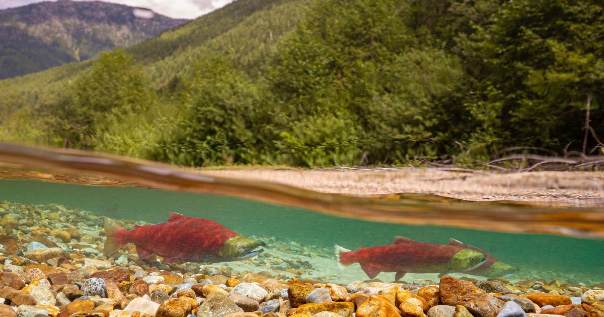
Two sockeye salmon swimming in a river.
Photo by Fernando Lessa.

Spills happen

Spills originate from all manner of accidents. The 2005 train derailment that spilled caustic soda into the Cheakamus River that killed 500,000 fish, The 2015 spill of 3,000 L of Bunker C oil from the MV Marathassa into English Bay. The 2020 fire aboard the MV ZIM Kingston in Juan de Fuca Strait that resulted in the loss of 104 mixed cargo shipping containers into the ocean. Each and every accident is bad news, and threatens the health of fish and whales, and contributes to the degradation of their habitats.

Being prepared is key

Given the sudden and unpredictable nature of oil and chemical spills, our oil and chemical spill response work entails being agile and available for support to First Nations, government agencies, and industry during a major spill. We are developing science protocols, and acquiring sampling kits, field equipment, and safety gear, and are poised to deploy our team to the scene of a spill. 

Being prepared on all fronts is key to limiting the damage from a spill. We recognize that with spills, it’s not a matter of if, but when. Research and monitoring to confirm the origin of the spill, track the fate of the spilled product, and monitor the recovery of ecosystem components routinely fails to be a priority. We will deploy expert capacity where and when needed, and work to prevent harm to valued ecosystem components.
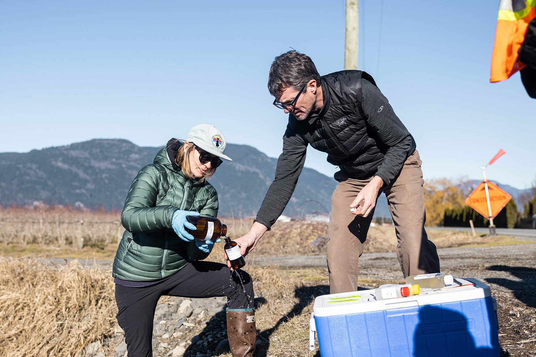
Two people working together to collect water samples in a farm field with the mountains in the background.
Photo by Alex Harris.
https://www.raincoast.org/reports/flood

Semá:th X̱ó:tsa (Sumas Lake) Floods of 2021

The catastrophic floods of late 2021 in southern British Columbia (Canada) and neighbouring Washington State (USA) destroyed homes, farms and businesses, with excess water spilling debris, animal carcasses and diesel fuel into historically productive fish habitat. 

We assembled a team to assess water quality in the former Semá:th X̱ó:tsa (Sumas Lake) area of the Fraser Valley over a seven-week period after the floods. We collected water samples from 11 surface water sites and four groundwater sites for comprehensive contaminant analysis and a subsequent risk-based evaluation. We measured 379 analytes (chemical components and bacteria), including 262 anthropogenic contaminants. We examined excess nutrients, metals, fecal coliform, hydrocarbons, pesticides, pharmaceuticals, and personal care products, perfluorinated compounds, sucralose, and tire-related chemicals.

Recent articles

Brian Falconer at the helm.

Isn’t there a better way to manage bears?

SPRING HUNT 2010 By Chris Genovali A new decade has dawned, but this month yet another year of grizzly bear hunting will commence in British Columbia. The B.C. grizzly bear hunt has been a source of unrelenting controversy. Both sides are stuck in a continual expert-driven argument in which each camp claims science supports their…
dummy-img

Royal Victoria Marathon 2010

Raincoast is an official charity of the charity pledge program of the Royal Victoria Marathon. We are looking for runners for the October 2010 race.    Its a beautiful time of year to run the waterfront streets of Victoria and this a qualifier for the Boston Marathon.  The salmon and bears need you! Sign up…
What's at Stake Report Cover

What’s at stake? Canada’s west coast

[youtube =http://www.youtube.com/watch?v=rU3emD_0HLk] The Canadian Federal government is pushing a proposal to ship tar sands oil by tanker through Canada’s Inside Passage . These tankers must navigate dog leg channels, rocky courses, unpredictable and sometimes violent weather after leaving the proposed terminal in Kitimat, BC. These routes would bring tankers into BC’s productive, diverse and fragile…
dummy-img

Last Stand of the Great Bear

Done in production with National Geographic, this trailer highlights the full length feature on large carnivores and Raincoast’s work to protect them in the Great Bear Rainforest.  
A group of orca whales swimming in the water.

Courting the Next Exxon Valdez

Counterpunch, By Chris Genovali, Paul Paquet and Misty MacDuffee The BC coast is a fragile archipelago with a boundary between land and ocean that changes by the hour, by the season and over millennia.
A group of orca whales swimming in the ocean.

British Columbia’s coast in the balance

Island Tides, Apr 1, 2010 Chris Genovali, Paul Paquet and Misty MacDuffee In this part of the world March 24 will, to borrow a phrase from Franklin Delano Roosevelt, live in infamy; it’s the anniversary of the Exxon Valdez oil spill disaster that took place in Alaska’s Prince William Sound in 1989.
A woman wearing a black jacket.

Tankers and oil spills could reverse years of recovery efforts

By Chris Genovali Lessons from the Exxon Valdez oil spill in Alaska have shown that even after two decades, some species and fisheries still have not recovered. This includes killer whale populations, some seabird populations, shellfish harvesting and the commercial herring fishery. If the proposed Enbridge Northern Gateway pipeline is constructed from Alberta’s tar sands…
A bear is sitting on the shore of a body of water.

Oil spill would devastate BC wildlife: report

Fragile Ecosystems Judith Lavoie, Financial Post Tuesday, March 24, 2010   Whales, wolves, bears and birds would be devastated by an oil spill in the waters north of Vancouver Island and off Haida Gwaii, says an extensive new study.  Photo: Chris Darimont, Raincoast.org The extent of a simulated oil spill is marked in dark grey…