We’re using drones to find salmon cooling centres
Rivers are warming due to climate change. Where do salmon go to cool down, and what can we do to help them?
We crane our necks and squint our eyes as the drone takes off with a poof of dust. Our stress levels are understandably high; we just sent a $30,000 piece of equipment flying off into the distance. We watch as it tracks a sinuous path over the river, adjusting the camera here and there to make sure we’re getting a smooth video. After an agonizing 15 minutes in the air, the drone comes back to us, going from a distant speck in the sky to 20 meters above our heads in the span of a minute. As it comes to a safe landing, we breathe a sigh of relief and ask ourselves for the hundredth time…How did we end up working on this project?


I’m back in the Coldwater River, near Merritt, for the second summer in a row working on a collaborative project with Scw’exmx Tribal Council and Citxw Nlaka’pamux Assembly. After spending 2024 understanding the effects of low stream flow on salmon, we’re focusing our efforts this year on another major concern for salmon in the Coldwater River: ironically, hot water.
Salmon are a cold-water fish, they thrive in water temperatures that would make most people think twice about jumping in (5-13ºC). Once the water hits ~ 18ºC, they start to experience stress that can impact their survival. Above 25ºC, salmon can die.
Despite its name, the Coldwater River can get pretty hot in the summer. This year, we’ve recorded temperatures reaching upwards of 27ºC. While high summer temperatures are a natural part of the geography and climate of the area, the region is experiencing hotter and drier summers as a result of climate change. This poses a threat to the salmon species that live in and spawn in the watershed, particularly because they either live in the river year-round (coho salmon) or return to spawn in the river during the summer (Chinook salmon). Piled on top of other issues in the area like drought, habitat loss, water pollution, and land-use change, high water temperatures are a key issue to address if we are to recover these struggling salmon populations.

There is hope, though, in what are known as thermal refuges. These are spots within the river that are significantly colder than the surrounding water, and stay cold even when the rest of the river gets hot. This is because they are sites where groundwater bubbles out of the ground and into the river, and groundwater stays cold in the summer. Groundwater is stored underground, where it is shielded from the sun and insulated from the summer heat. Much like how a basement stays cold in the summer, thermal refuges provide relief for fish in hot water. Much like city cooling centres, thermal refuges quite literally save lives during heatwaves.
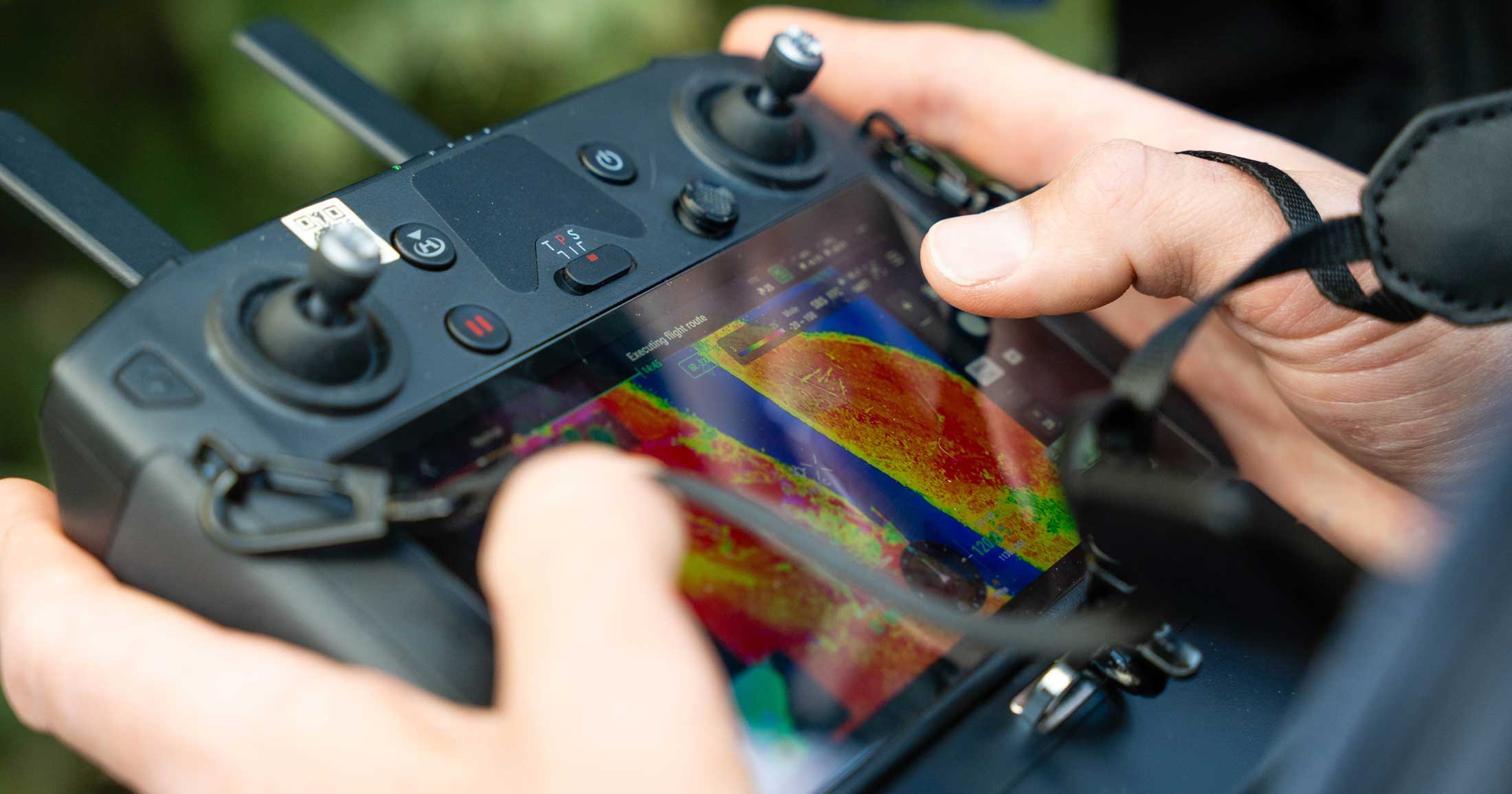
The goal of our project is to determine where thermal refuges in the Coldwater River are, what they look like, and how fish use them. We’re accomplishing this by surveying the river using a drone equipped with a thermal infrared sensor. This gives us a colour-coded video of the river displaying real-time water temperatures. Thermal refuges show up as darker blue spots, indicating colder pockets of water. Using the drone allows us to survey more of the river, and quicker, compared to being on foot. Once we find a thermal refuge with the drone, we visit them on foot to measure their size, record their actual water temperature, take note of riparian (streamside) and aquatic habitat, and identify potential threats to them, like nearby development or industry.

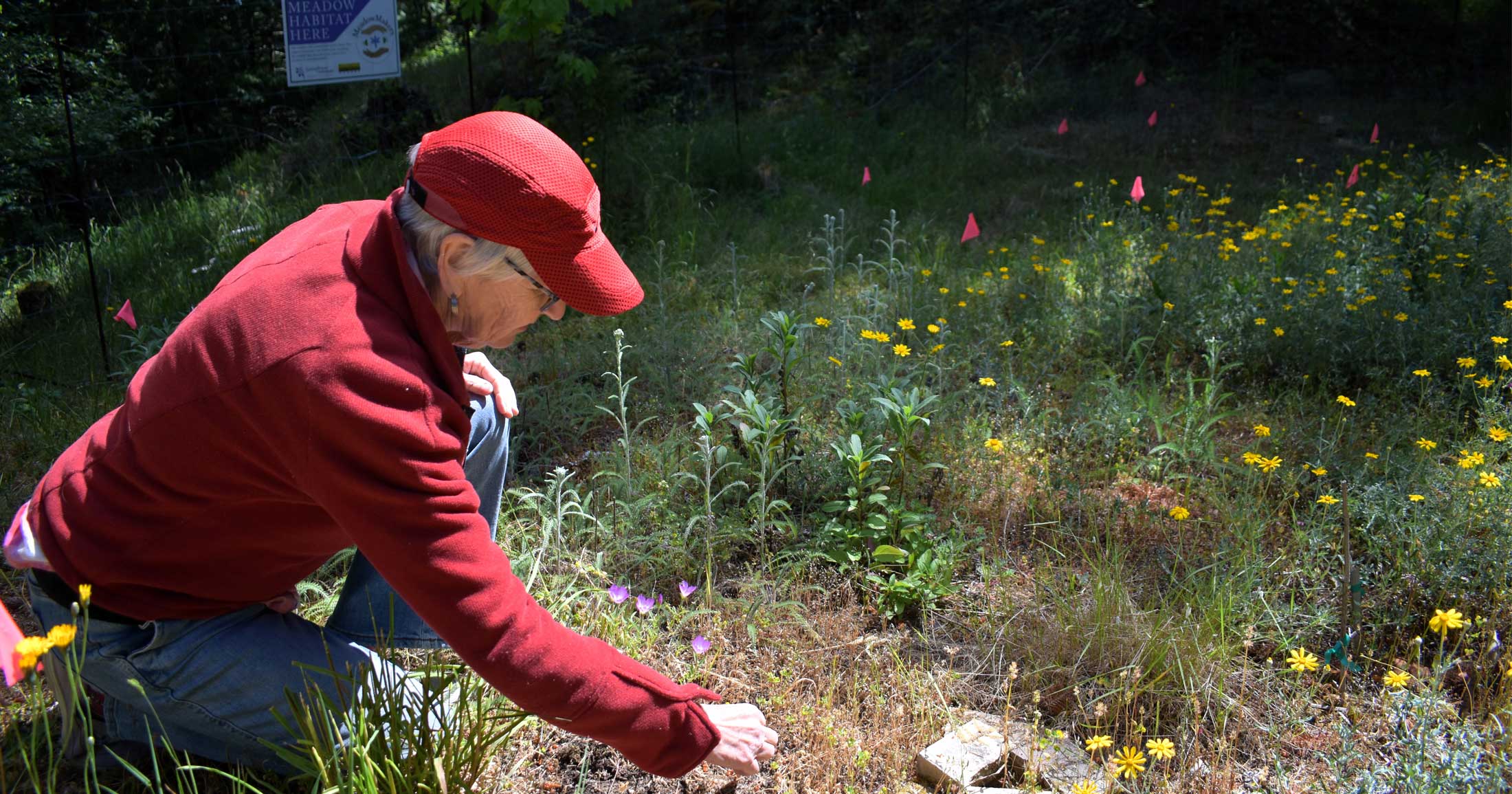
These site visits also involve the best part of this project in my opinion: snorkel surveys. By putting a dive mask on and actually getting in the water, we can survey underwater habitat and count the number of fish using these sites in a way that can’t be accomplished by any other method. During these swims we’re noting which species of fish we observe, their life stage (juvenile or adult), and getting a sense of the habitat they are living in. For me, this is the most rewarding part of the project. There’s nothing that improves your understanding of salmon habitat than actually getting into it and taking a look.


So after collecting this data, now what? Data can’t help salmon unless it leads to action. Once we have an inventory and understanding of thermal refuges, we can then act to protect, restore, enhance, and monitor them. For example, if a site is located near a planned groundwater extraction site, we can bring our data to decision-makers to urge them against approving a groundwater licence. We can also enhance these sites so that they provide better habitat for fish. Adding complex wood, re-arranging rocks and boulders, planting shade trees, and other techniques can help fish make better use of these important refuges.


One technique we are experimenting with is applying shade with tarps over thermal refuges that currently lack riparian plants that provide shade. Shade may be able to help some thermal refuges stay colder longer, through extreme heatwaves. Due to extensive development in the watershed, many thermal refuges lack trees and plants that can naturally provide shade. Artificially shading these sites can be an interim fix while replanting efforts are ongoing.
Overall, this project has been another incredible experience collaborating with a great team. We’re excited to translate our work to action in the near future, and grateful for the support of the Watershed Security Fund and Pacific Salmon Foundation, who are making this project possible.