New research highlights important routes to spawning salmon for coastal bears
Hey Siri – what’s the best route to a seafood joint?
Like Google Maps for Salmon-seeking Bears, a new study, “Modeling Functional Connectivity for Bears Among Spawning Salmon Waterways in Haíɫzaqv (Heiltsuk) Territory, Coastal British Columbia” in the journal, Ecology and Evolution, predicts key connectivity routes for grizzly and black bears among spawning sites used by salmon.
Mihalik I, Bourbonnais M, Housty W, Starr K, Paquet P, Darimont C. 2025. Modeling Functional Connectivity for Bears Among Spawning Salmon Waterways in Haíɫzaqv (Heiltsuk) Territory, Coastal British Columbia. Ecology and Evolution. 15(7). doi:https://doi.org/10.1002/ece3.71579.
The team from the University of Victoria, Raincoast Conservation Foundation, and the Haíɫzaqv (Heiltsuk) Integrated Resource Management Department (HIRMD) developed and validated a connectivity model to estimate bear travel routes across a rugged landscape that hosts dozens of spawning locations scattered over 5,618 km2. The work answered the call to identify likely movement pathways for bears to be incorporated into landscape planning by HIRMD.
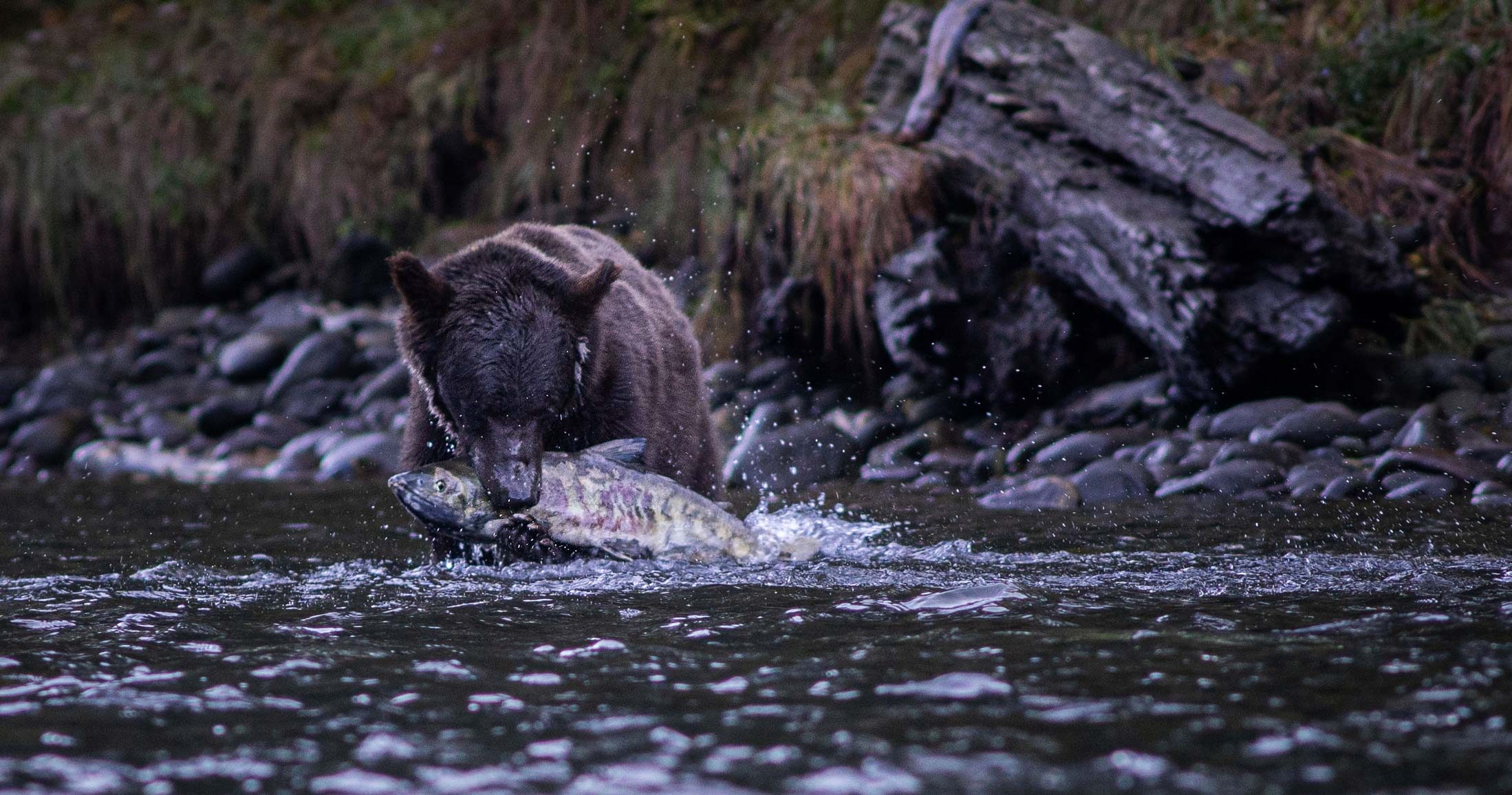
Coastal bears take advantage of the wave of spawning salmon that hit freshwater systems at different times along the coast each year. Key to a successful season of gorging on seafood without huge energy investments or risk-taking, however, is avoiding rugged terrain and industrial disturbance. “Coastal grizzly and black bears both benefit from access to diverse salmon spawns” says Ilona Mihalik, lead author from the Raincoast Conservation Foundation and PhD Candidate at the University of Victoria. “With this in mind, our aim was to collaboratively identify the routes bears might take on the landscape to access the different spawns throughout the season. Heiltsuk Knowledge was a big part of our model-building process,” adds Ilona.
William Housty, ED of HIRMD, started the first study of bears in Haíɫzaqv Territory in 2007, and now puts research findings into action in his role overseeing stewardship decisions. “This new study helps fill an important gap. Identifying candidate corridors to consider safeguarding from industrial practices can provide bears safe passage to support their feeding throughout the spawning season. It’s a strategy to give them a little something extra beyond our large series of protected areas.”
A model is only as good as its performance in making accurate predictions. This study took advantage of long-term non-invasive genetic sampling of fur captured across the same Haíɫzaqv landscape. Validation steps indicated that the model accurately predicted the likely routes individual bears traveled among sampling sites. “It’s not the first time or the last time that Heiltsuk Knowledge shows its value and ultimately supports our decision-making in the modern world,”says Housty.

Abstract
Understanding how functional connectivity can provide mobile consumers access to key resources can inform habitat management. The spatial arrangement of landscape features, for example, can affect movement among resource patches. Guided by the Haíɫzaqv (Heiltsuk) Integrated Resource Management Department (HIRMD), and within Haíɫzaqv Territory, coastal British Columbia (BC), Canada, our objectives were to (1) estimate functional connectivity for grizzly and black bears (Ursus arctos and U. americanus, respectively) among aggregations of spawning Pacific salmon (Oncorhynchus spp.), (2) identify important movement pathways for landscape planning, and (3) contribute to the growing body of functional connectivity research on dynamic ecological systems. Using circuit theory and least cost paths, we predicted movement among salmon spawning reaches within a 5618 km2 study area. Variables affecting bear movement were parameterized by drawing on the relevant literature and Haíɫzaqv Knowledge. We validated our cumulative resistance surface with observed movements as identified via genetic recapture data. Modeled current from Circuitscape suggested areas of high connectivity between salmon spawns within and among watersheds. Our least cost paths model identified principal routes, which we then ranked to illustrate possible corridors for consideration by HIRMD planners. Understanding movement among salmon spawns, a fitness-related food, provides key information to inform landscape planning for bears. Further, our work provides an example of connectivity research codeveloped, executed, and applied with an Indigenous government.
Figure 1

Figure 2

You can help
Raincoast’s in-house scientists, collaborating graduate students, postdoctoral fellows, and professors make us unique among conservation groups. We work with First Nations, academic institutions, government, and other NGOs to build support and inform decisions that protect aquatic and terrestrial ecosystems, and the wildlife that depend on them. We conduct ethically applied, process-oriented, and hypothesis-driven research that has immediate and relevant utility for conservation deliberations and the collective body of scientific knowledge.
We investigate to understand coastal species and processes. We inform by bringing science to decision-makers and communities. We inspire action to protect wildlife and wildlife habitats.