Thermal refuges in the Coldwater River
How salmon are coping in one of BC’s hottest rivers.
A project by Raincoast, Scw’exmx Tribal Council, and Citxw Nlaka’pamux Assembly.
February 18, 2026
Climate change and salmon
Rivers across western North America are warming, and fast. These changes are pushing cold water fish like salmon to the edge of their tolerance. Scientists are racing to understand how salmon will respond to climate change and what we can do to give them a fighting chance.
In British Columbia, summers are getting hotter and drier, while winters receive less snow and more rain. Combined, these impacts result in stressful conditions for salmon across their life cycle, especially for watersheds in naturally drier, warmer climates.
This is the Nicola Watershed, a sub-basin of the larger Thompson and Fraser Watersheds. Located in the heart of BC’s arid southern interior, it’s home to some of the most vulnerable salmon populations in the province.
The Nicola lies to the east of the Coast Mountains. It marks the end of the wet, temperate coast and the beginning of the dry, continental interior. The region is home to black-tailed deer, ponderosa pine, osprey, and black cottonwood.
The Nicola is also characterized by fire, which has shaped the ecosystem for millennia. Climate change and a legacy of forestry have made recent fires in 2021 and 2025 burn hotter, and longer than ever before.
Salmon that call the Nicola home include Interior Fraser Coho, Lower Thompson Chinook, and Interior Fraser Steelhead, three populations currently assessed as endangered or threatened by COSEWIC . The watershed also supports resident populations of Bull Trout, Mountain Whitefish, and Rainbow Trout. These fish have evolved over thousands of years to thrive in the unique environment of the Nicola.
The Nicola contains some of the warmest salmon streams in the province. Summer water temperatures have been recorded exceeding 25 ºC, which can be lethal for salmon. As climate change progresses, these extreme heat events are only becoming more frequent.
Will salmon be able to cope with the incoming heat? We wanted to find out.
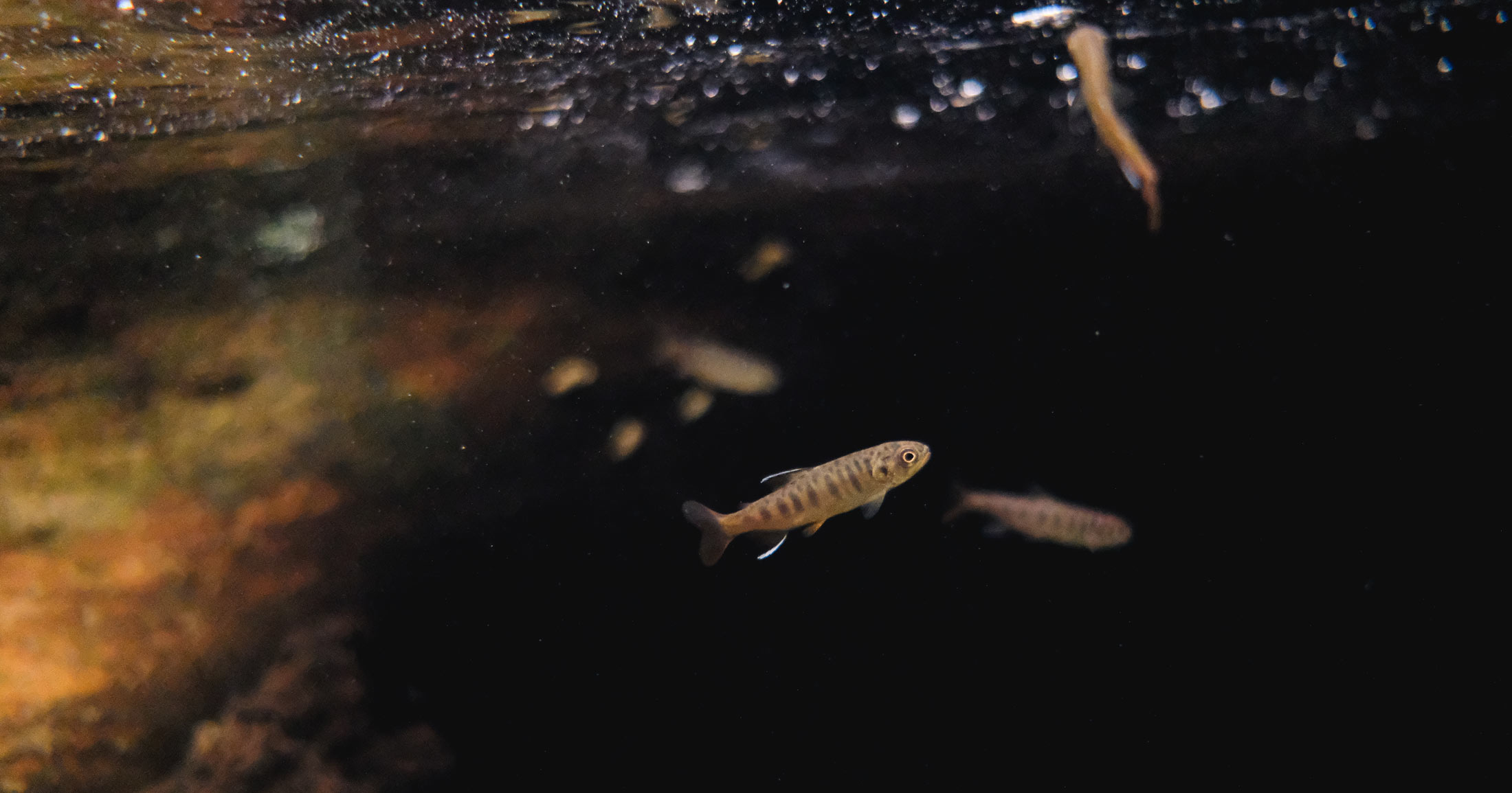
Juvenile coho salmon and mountain whitefish congregating at a small thermal refuge. Video by Ben Zdasiuk.
Thermal refuges
Thermal refuges are areas within a stream that stay cold, even as the surrounding water heats up. Often, this phenomenon occurs where groundwater mixes with surface water. Groundwater is unaffected by changes in air temperature and therefore can be up to 10 ºC cooler than surface water. At these aquatic cooling centres, fish congregate during the heat of the summer to find refuge. One way to find thermal refuges is using thermal infrared imaging. Temperature differences that are invisible to the naked eye as displayed clearly: darker blues indicate colder temperatures. By identifying and mapping thermal refuges we will have a better understanding of how they are formed, what threats they face, and how they can be restored.


Using a drone equipped with a thermal sensor, we conducted aerial surveys of the Coldwater River, an important salmon stream in the Nicola watershed. The Coldwater is fed by snowmelt in Coquihalla Pass, and runs adjacent to the Coquihalla Highway to its confluence with the Nicola River in the town of Merritt. Climate change driven declines in winter snowpack combined with human water demands, and a legacy of forestry have severely impacted the natural flow and temperature regime of the river. In the summer of 2024, water temperature sensors in the river recorded a daily high of 27 ºC, warm enough for people to swim in all day but lethal to salmon.


40
kilometers of river surveyed
38
thermal refuges identified

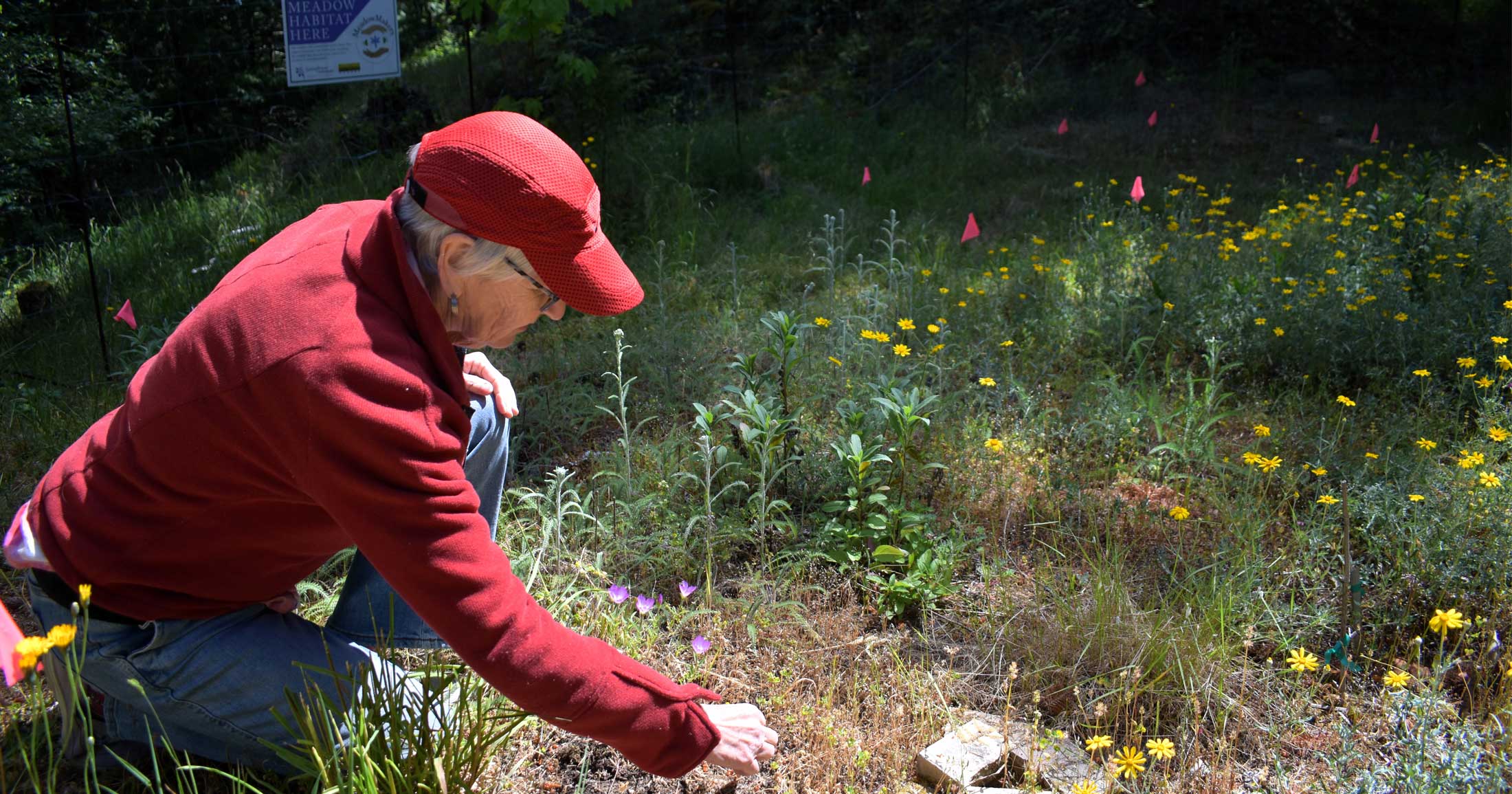
On the ground and in the water
We visited several thermal refuges identified by the drone, where we conducted snorkel surveys. This helped us verify the accuracy of our thermal images and make observations of features such as riparian vegetation and woody debris, which are crucial components of high quality salmon habitat. We also wanted to understand what kinds of fish were using these habitats, and how.


What do thermal refuges look like?
The thermal refuges we found were highly varied, from small seeps and crevices to large off-channel pools. At the height of summer, these refuges were up to 8 ºC cooler than the mainstem river. Interestingly, all of the refuges that we visited were off-channel habitats that were heavily utilized by juvenile salmon. None of the refuges we found were deep enough or had adequate flow to support adult salmon. Due to the impacts of recent wildfires and recent flood recovery works, many refuges would benefit from habitat enhancement measures such as riparian planting.


Example 1: Small refuge
This small refuge ~ 100 m2 was located in the town of Merritt. It had an engineered rip rap bank, which limited good habitat qualities like riparian vegetation and woody debris. While it was cold, only a few salmon were observed here.


Example 2: Large refuge
This large refuge was located in within a relic channel. Lateral migration of the river sometime after 2023 left behind large cold pools that are connected to the mainstem. We observed thousands of juvenile salmon here, however water quality metrics like dissolved oxygen and turbidity were poor in the stagnant areas.


Example 3: Large refuge
This large refuge was 2500 m2 with a water temperature of 16.2 ºC. We observed thousands of juvenile coho salmon, in addition to juvenile mountain whitefish and adult rainbow trout. A beaver dam was observed near the groundwater upwelling site, which may have contributed to the vast size of the refuge.


Example 4: Reliable refuge
This refuge was created at the confluence of a cold tributary. These refuges have the highest potential for enhancement, restoration, and protection as they are the most persistent and reliable refuge type.

Our surveys identified three large gaps between thermal refuges along the length of the river. These gaps are roughly three kilometers long and could pose a connectivity barrier for fish during extreme heat. Targeted restoration within these gaps can help fish “leapfrog” between thermal refuges and access more of their habitat.
Flooding: a silver lining?
One of the biggest insights of our project was the correlation between thermal refuges and lateral channel migration following the devastating November 2021 flood that drastically changed the river. The 1-in-400 year flood event led to the reconnection of the river to its floodplain, opening up opportunities for groundwater to be expressed into the river. In 2017, a drone-based thermal mapping effort of the Nicola River by Dr. Tom Willms showed that the number of thermal refuges increased significantly following a flood.


What’s next?
Our team is currently working to apply our findings to inform real-world actions that will benefit salmon and their habitat in a warming world. In the short-term, this means planning for habitat restoration and enhancement to increase shading, add structure, and support the food web at thermal refuges. In the long-term, our findings will support the ongoing development of watershed-scale recovery plans.
Salmon are an irreplaceable part of the ecosystem and culture of the Nicola watershed. Ensuring that they thrive in the Nicola as they have for thousands of years is not just a goal–it’s a responsibility.
Watch our season recap!
With support from
Project team
Auston Chhor (Raincoast Conservation Foundation)
Nathan Lustig (Scw’exmx Tribal Council)
Bret Spahan (Citxw Nlaka’pamux Assembly)
Issac Manuel-Joe (Citxw Nlaka’pamux Assembly)
Special thanks to
Ariel Voght
Kristen Walters
Marc Porter
Ben Zdasiuk
Eric Saczuk

Canada has the policy tools to protect Pacific salmon. Why aren’t they working?
A new peer-reviewed perspective examines why decades of ambitious conservation policy have failed to halt wild salmon declines and what…